Abyss
A window into the deep ocean

0
Connections
A window into the abyss.
Turn your TRMNL into your personal window into the deep ocean. Abyss lets you peek into a fascinating corner of our planet: the deep Pacific. Explore hydrothermal vents on Axial Seamount, a methane seep at Southern Hydrate Ridge, and the Oregon Offshore seafloor. These are real research camera images from places most of us will never visit.
Choose your view
Cycle through all four cameras, choose a few favourites, or settle into one. Leave the camera selection empty to rotate through every published camera.
The default 15-minute refresh rotates your selected views. Images are processed every three hours from periodic recordings and snapshots. When a camera cannot update, its last good image stays on display.
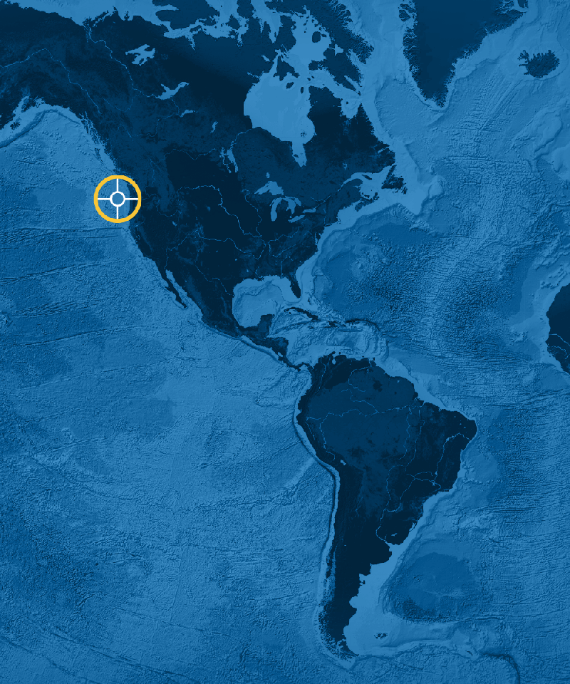
Where are the cameras?
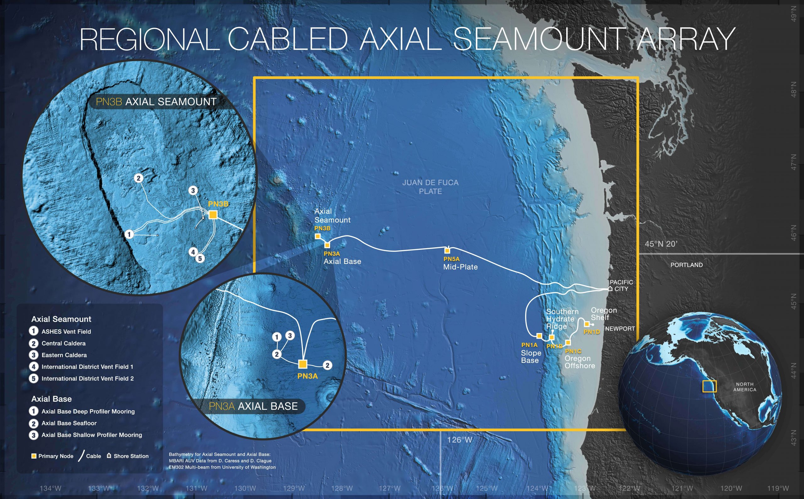
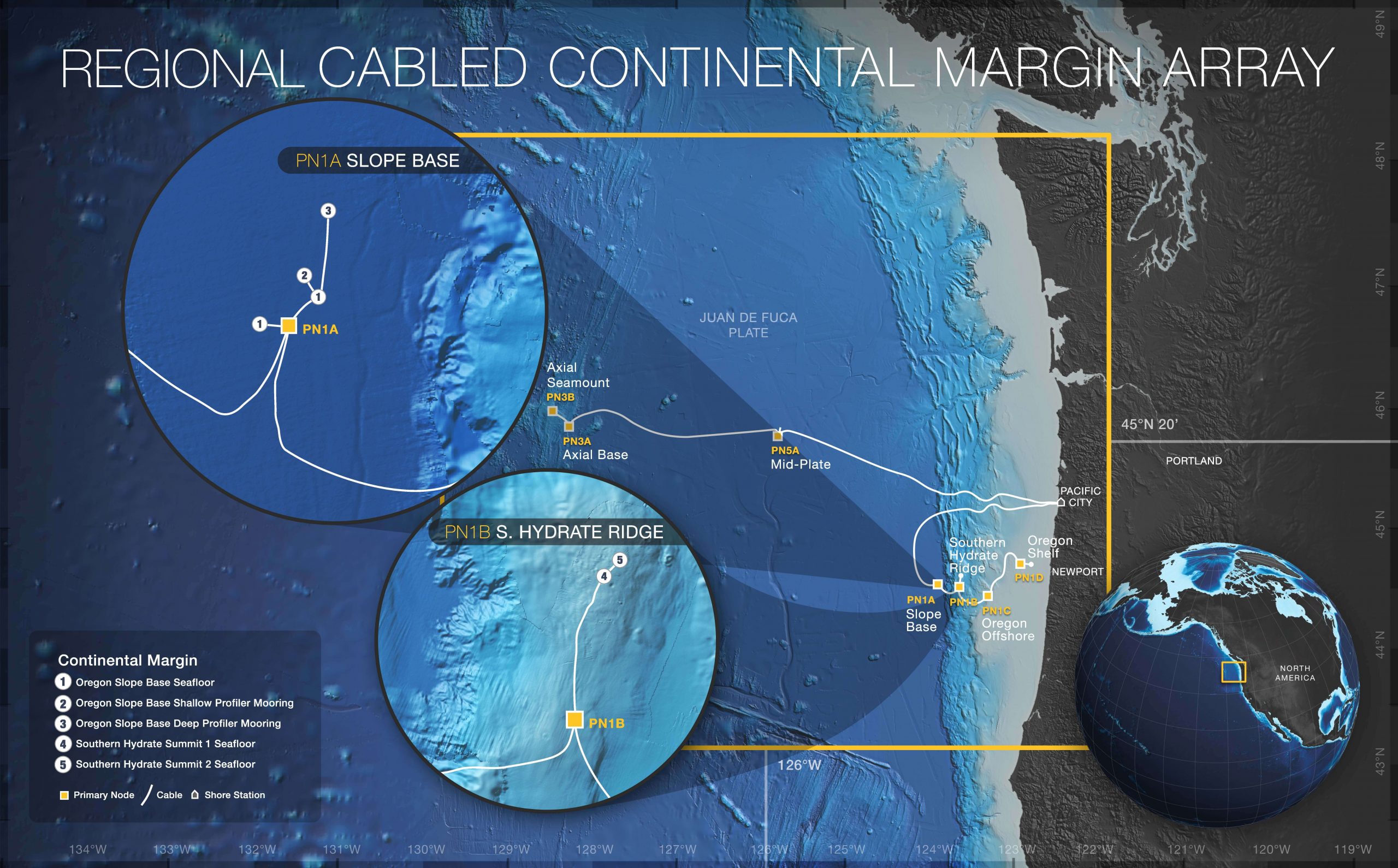
Four camera views across three research sites in the northeast Pacific. Both vent cameras are on Axial Seamount; the other cameras look across Southern Hydrate Ridge and the Oregon Offshore seafloor. All depths are approximate.
ASHES: Mushroom vent — about 1,540 m
On Axial Seamount, an active underwater volcano on the Juan de Fuca Ridge. This camera looks into the ASHES hydrothermal vent field, where hot fluids emerge from the volcanic seafloor.
Explore the research site · Detailed site map
International District: Tiny Towers — about 1,520 m
A second hydrothermal vent field on Axial Seamount. The Tiny Towers camera offers another view of the volcano's deep-sea habitat.
Explore the research site · Detailed site map
Southern Hydrate Ridge: Einstein's Grotto — about 780 m
About 90 km west of Newport, Oregon, on the Cascadia continental margin. This camera looks across Einstein's Grotto, an active methane seep. It is a separate site from the volcanic vent fields at Axial Seamount.
Explore the research site · Detailed site map
Oregon Offshore: seafloor — about 580 m
On the continental slope off Oregon, camera CAMDSB106 looks across the seabed from the Oregon Offshore benthic platform. Fish and small seabed animals appear in its periodic snapshots.
Explore the research site
Explore the maps
Regional cable-network map — Center for Environmental Visualization, University of Washington.
University of Washington interactive observatory map
Axial Seamount maps and diagrams · Array illustration
Continental-margin maps and diagrams · Array illustration
Maps, diagrams and site photographs remain on their official OOI and University of Washington pages with their original captions and credits. Site maps: M. Elend, University of Washington; deployment dates appear in the source captions.
Made possible by open ocean science
This window is made possible by public investment in science. The U.S. National Science Foundation funds the Ocean Observatories Initiative, whose Regional Cabled Array connects deep-ocean instruments to shore through a 900-kilometre network of power and data cables. Scientists, engineers and research crews keep this observatory running, and open data lets the rest of us look in.
Credits and acknowledgment
Ocean Observatories Initiative / Woods Hole Oceanographic Institution OOI Program Office / University of Washington; supported by the U.S. National Science Foundation, Cooperative Agreement 2244833.

Available settings
Underwater cameras
Leave all feeds deselected to cycle through every feed. Select one to pin it, or several to cycle through that subset. Offline cameras keep their last best image.
Show QR code
Full-screen view only: scan the QR code overlay to open this exact image or video recording on your mobile device.
Dive edge to edge?
Fill the photo area for a closer look into the deep. Some edges may be cropped. Leave off to show the entire image.

What to Wear: Weather Forecast
weather forecast with outfit tips

ISS Tracker Map
Where on earth is the space station
Ridgelines: Daily Mountain Art
The mountains are calling

Map of the Day
Antique maps, every morning

Postcard of the Day
Vintage postcards from everywhere